Ground Penetrating Radar Model Results
Please forgive the disjointed feel of this page. It was done to quickly record/document these results.
These are the results from an updated model of our GPR system.
The model accounts for:
- 1/r^2 Path Loss
- Direct path transmitter to receiver transmission
- A second order model for the sand reflection
- Sand reflective index
- Steel reflective index
The model was created by putting square pulse and delta functions at the appropriate x-y-z coordinates. Signals were then generated from those functions .
The first row of images represents this "physical" image.
This "physical" representation was then convolved with the "impulse" signal (measured from the actual system).
This convolution generated the signals the radar would actually perceive.
Three forms of digital processing were performed on the images:
- The signals were replaced by their absolute values.
- The signals were normalized by the distance squared to remove path loss.
- The signals were match filtered with the "impulse signal" to detect high correlation.
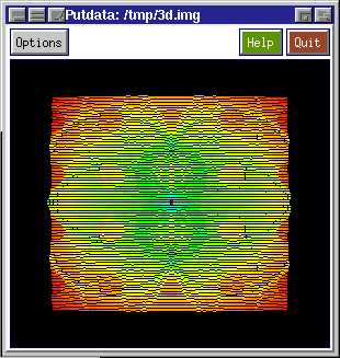
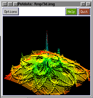
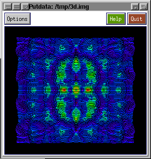
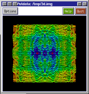
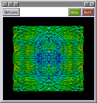
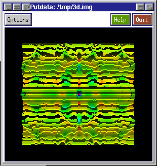
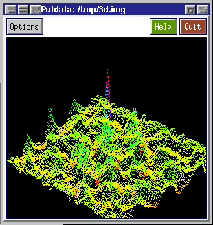
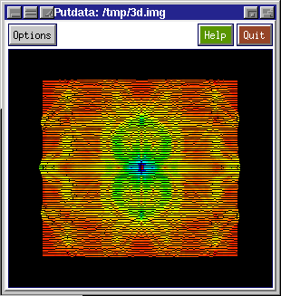
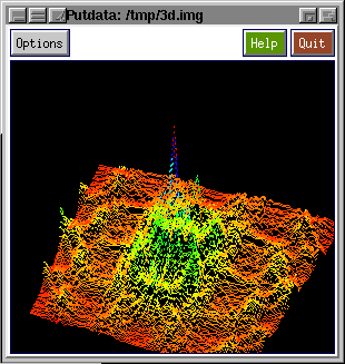
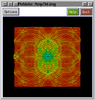
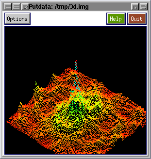
NOTE: In the following images color signifies amplitude. The red end of the spectrum denotes lower values and the blue denotes higher values.
| Simulation
Input data |
x-y plane vs amplitude |
40 degree view |
| Physical model - Delta & Step Functions, Path Loss |
|
|
| Model as observed with the radar signal - No processing |
|
No significant image |
| Model w/t radar signal - Absolute value (ABS) |
|
No significant image |
| Model w/t radar signal - ABS and Normalized for path loss (Normal) |
|
No significant image |
| Model w/t radar signal - Match filtered (Corr) |
|
|
| Model w/t radar signal - Corr, ABS |
|
|
| Model w/t radar signal - Corr, ABS, Normal |
|
|
Click here to see our GPR detect sand (a non-metalic substance).
Click here to see our GPR real world results.
Click here to see the time domain data that generated those results.
Initial work by Bill Sunlin and Brian Hunt
Current model, implementation, exploitation and results by Donald Kerns
3D-Plots generated using Khoros by Khoral
dak 4/20/97